Bhumi ATR/BPN, Implementation of Public Information Disclosure that Receives International Appreciation.
Jakarta, POSINTERNASIONAL.COM
Recently, Bhumi ATR/BPN has been increasingly discussed and widely accessed by the public.
The platform developed by the Ministry of Agrarian Affairs and Spatial Planning/National Land Agency (ATR/BPN) was first planned in 2010 and officially launched in 2012.
Bhumi ATR/BPN offers geospatial data that can be directly accessed by the public, and recently received international appreciation at a meeting of geospatial experts in Bali.
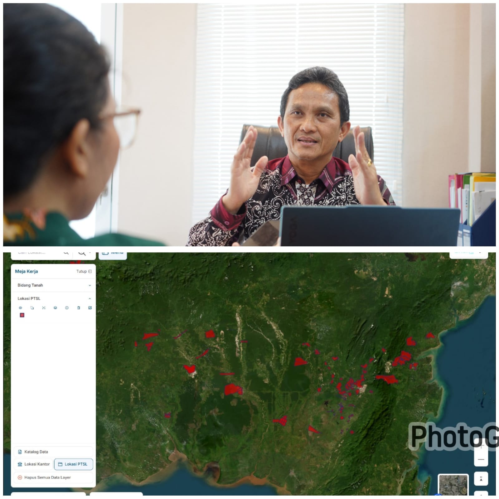
“We want the public to be able to easily access interactive maps, have location search tools and geospatial information,” explained the Director of Cadastral Measurement and Mapping, Herjon Panggabean.
Who was met at the Office of the Directorate General of Land and Spatial Surveys and Mapping, West Kuningan, South Jakarta, Friday (01/24/2025).
According to him, Bhumi ATR/BPN is an implementation of Law Number 14 of 2008 concerning Public Information Disclosure, which aims to provide transparent access to information to the public.
Not only that, Bhumi ATR/BPN also provides a feature that allows the public to check and view maps of their own land plots, based on the certificates they have.
This feature is very useful for ensuring that the location and shape of the land are in accordance with those stated on the certificate.
Bhumi ATR/BPN also displays information about the Land Value Zone, which helps the public know the range of land values in their location.
“We make it easy for the public to check the position, shape, and information related to their land.
If there is a difference with the data in Bhumi.atrbpn, the public can immediately report to the local Land Office or submit it via #TanyaATRBPN,” added Herjon Panggabean.
Before accessing this platform, the public is asked to agree to the disclaimer that appears as a reminder of the importance of the accuracy of the information provided.
In addition to the general public, Bhumi ATR/BPN also provides convenience for various parties, including professionals, government, and other stakeholders, in accessing spatial data on spatial planning and land.
This will certainly increase efficiency in government and sustainable development, while supporting the achievement of good governance that prioritizes accountability, transparency, and community participation.
Regional governments can also utilize Bhumi ATR/BPN to determine taxes related to land.
Through Bhumi ATR/BPN, the Ministry of ATR/BPN hopes to improve the performance and effectiveness of their institutions in serving the community.
The Ministry of ATR/BPN also expressed its appreciation to the community who have utilized this platform and provided input for further improvements.
“Bhumi has become an important tool for us to monitor and evaluate our performance.
We also appeal to land certificate owners to ensure that their data has been plotted in Bhumi ATR/BPN. If not, they can do swapplotting or contact the local Land Office,” said Herjon Panggabean.
(trisno).