To ensure the program’s success, the Ministry of Agrarian Affairs and Spatial Planning/National Land Agency (ATR/BPN) is working to strengthen spatial planning.
JAKARTA, POSINTERNASIONAL.COM.
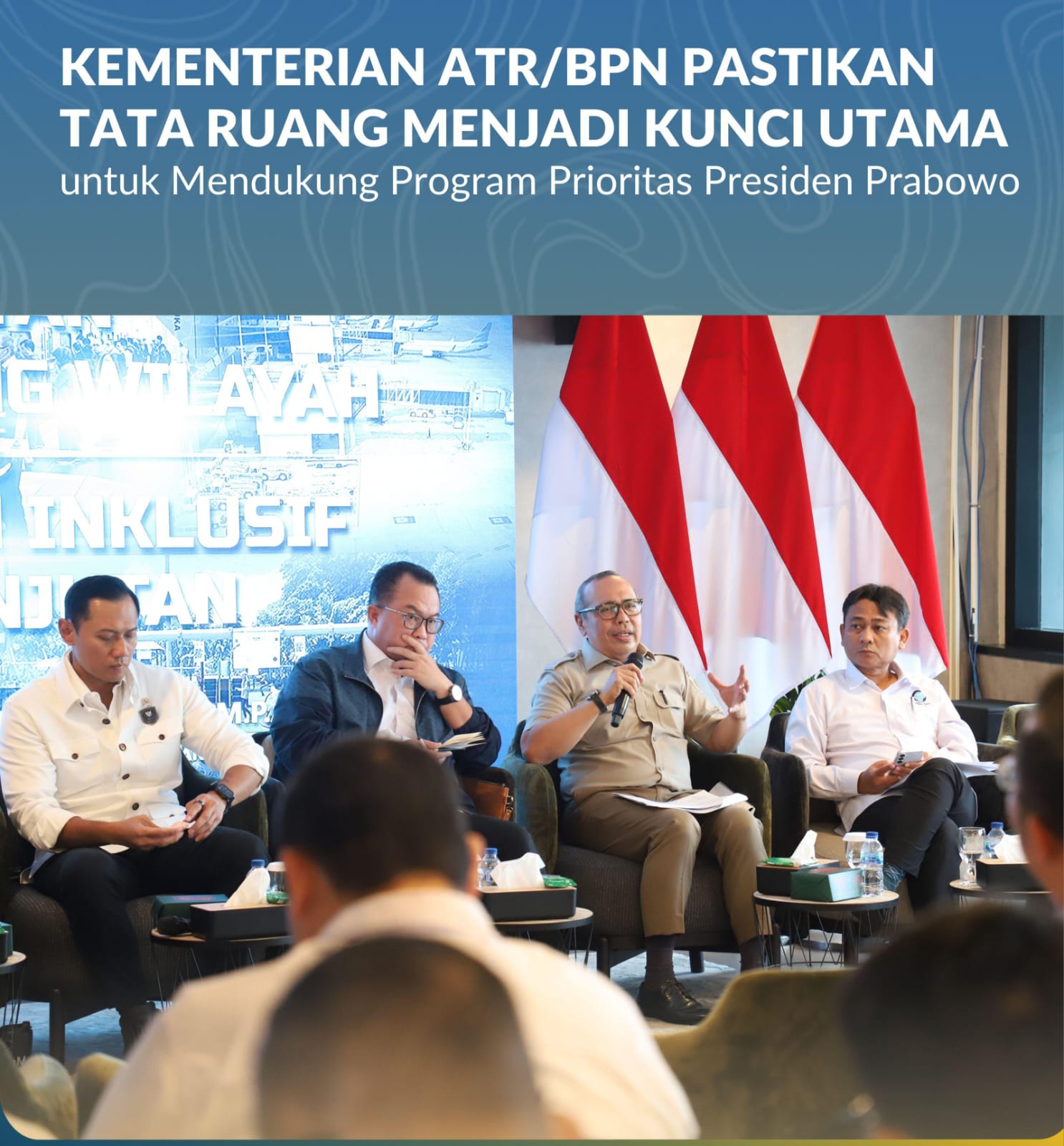
The Priority Programs promoted by President Prabowo Subianto need to be supported by planned spatial management to prevent land conflicts.
To ensure the program’s success, the Ministry of Agrarian Affairs and Spatial Planning/National Land Agency (ATR/BPN) is working to strengthen spatial planning as a key factor in inclusive and sustainable development.
(February 10, 2026).
“Food Self-Sufficiency, Energy Self-Sufficiency, Downstream Development, and the Construction of Three Million Homes require orderly, integrated, and equitable spatial management to prevent land use conflicts.
We must manage space well to prevent land use conflicts,” said the Director General of Spatial Planning, Suyus Windayana, during the Town Hall Meeting on Strengthening Regional Spatial Planning at the Coordinating Ministry for Infrastructure and Regional Development (Kemenko IPK), Jakarta, February 9, 2026.
In the context of national food security, the Ministry of Agrarian Affairs and Spatial Planning/National Land Agency (ATR/BPN) is striving to protect the designation of Sustainable Food Agricultural Land (LP2B) in Spatial Planning.
“Based on data from the Ministry of Agrarian Affairs and Spatial Planning/BPN, the allocation of Sustainable Food Agricultural Areas (KP2B) in provincial spatial plans has reached approximately 67.87%.
However, this figure is still below the target set in the National Medium-Term Development Plan (RPJMN), which is 87% of the area of Raw Paddy Fields (LBS) to be designated as permanent paddy fields,” said Suyus Windayana.
Challenges in this protection effort exist at the district and city levels.
Of the approximately 504 districts/cities, only 41.32% of the LBS area has been allocated in the Regional Spatial Planning (RTRW).
Only 104 districts/cities have completed their RTRW, and approximately 400 districts/cities still need to revise their RTRWs.
“For areas that are not yet compliant, because this concerns national food security, we will temporarily freeze land conversion in food-producing areas.
These areas must remain used as food-producing areas and cannot be converted,” emphasized the Director General of Spatial Planning.
Suyus Windayana also revealed that there have been policy reforms in spatial planning regulations that stipulate that changes to the Regional Spatial Plan (RTRW) no longer have to wait five years.
“Spatial plan revisions can now be carried out partially and more quickly, especially to align with national strategic policies, such as food security and disaster risk mitigation,” he explained.
In this meeting, Coordinating Minister for the Environment and Forestry, Agus Harimurti Yudhoyono (AHY), acknowledged that spatial planning is a key factor in regional development.
“Spatial planning must be the commander in chief of development.
This means that before planning infrastructure development in any sector, the spatial direction and boundaries must first be determined,” he said.
The inter-agency meeting was also attended by Deputy Minister of Home Affairs, Akhmad Wiyagus, and Deputy Minister of the Environment, Diaz Hendropriyono.
Deputy Minister of Maritime Affairs and Fisheries, Didit Herdiawan; Head of the National Research and Innovation Agency (BRIN), Arif Satria; Deputy Head of BRIN, Amarulla Octavian; Head of the Geospatial Information Agency (BIG), Muh Aris Marfai.
(trisno).